|
The HYDROCOASTAL final product was produced using
innovative retracking algorithms for the coastal zone (UBonn Statistical
STARS type) and inland waters (DTU: Multiple Waveform Persistent Peak, MWaPP),
which were selected as the best performing algorithms tested earlier in the project.
To provide continuity between river and coastal water levels, the DTU MWaPP algorithm was applied to all regions, coastal and inland waters.
THe U Bonn STARS type retracker was applied only to Coastal Zone data.
The product is provided at 3 levels:
- L2E: Level 2 Extended Product. Along track L2 product for all regions.
- L3: Inland Waters, Water Level Time Series. For all inland water regions.
- L4: Inland Waters, River Discharge Time Series. For selected inland water regions.
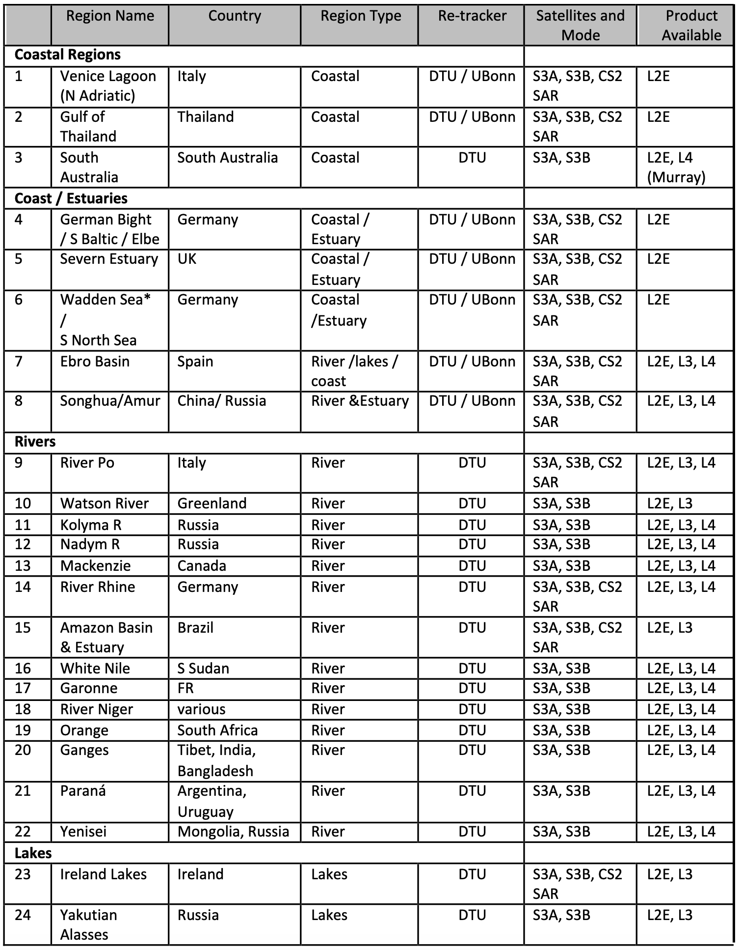
The source data are Sentinel 3A and Sentinel 3B SRAL L1a data, for all the operational mission to 30/09/2022
(S3A from 01/04/2016 to 30/09/2022, S3B from 11/05/2018 to 30/09/2022; South Australia starting from 01/01/2017)
and Cryosat-2 SAR mode FBR data, for all the operational mission available in Baseline D (from 06/09/2010 to 21/08/2021).
The Table below lists the 24 regions in the Final Product.
A readme document provides a full description of the data set.
The product formats are described in the HYDROCOASTAL Product Specification Document
The HYDROCOASTAL Final Product is freely available, please contact info@satoc.eu for
details
|