HYDROCOASTAL

Home | Documents | Products | Publications

HYDROCOASTAL is a project funded by ESA to maximise exploitation of SAR and SARin altimeter measurements in the coastal zone and inland waters, by evaluating and implementing new approaches to process SAR and SARin data from CryoSat-2, and SAR altimeter data from Sentinel-3A and Sentinel-3B.

New SAR and SARin processing algorithms for the coastal zone and inland waters will be developed and implemented and evaluated through an initial Test Data Set for selected regions. From the results of this evaluation a processing scheme will be implemented to generate global coastal zone and river discharge data sets. Case studies will assess these products in terms of their scientific impacts.
All the produced data sets will be available on request to external researchers, and full descriptions of the processing algorithms will be provided.

Latest news

Final HYDROCOASTAL Product
The Final HYDROCOASTAL Product is now freely available on request. It contains L2 outputs from the different candidate algorithms over 25 regions, L3 water level and L4 River Discharge time series for nineteen inland water regions.
A subset of the Initial Test Data Set is also available (for regions not covered by the Final Product).
Also a small coastal data set produced by isardSAT with their Coastal and Fully Focused SAR Processors is available.
For more details go to the products page

Final Review: 12 September 2023
The Final Review was held as a hybrid face to face and online meeting at ESRIN, Frascati.

Highlights were

  • Presentation and Review of the HYDROCOASTAL Project
  • Presentation and Review of Impact Assessment Reports and the draft Scientific Road Map

Final versions of the project deliverables will become available on the documents page)

Acceptance Review: 28 & 29 June 2023
The Acceptance Review was held as a hybrid face to face and online meeting at ESRIN, Frascati.

Highlights were

  • Review Final HYDROCOASTAL Output Products and associated deliverables
  • Report Impact Assessment Case Studies

Impact Assessment Case Studies

In the final phase of the project a series of 13 Impact Assessment Case Studies were carried out, to assess the potential scientific impacts of the improved coastal and inland water products generated by HYDROCOASTAL.

The outputs of these studies are summarised in the HYDROCOASTAL Impact Assessment Reports and also contribute to the recommendations in the Scientific Road Map(see the documents page.)

image001

Acknowledgements

The HYDROCOASTAL project was funded by ESA under the eo science for society programme (https://eo4society.esa.int/projects/hydrocoastal/)

The HYDROCOASTAL processor was implemented by isardSAT through a GBOX algorithm development and execution environment provided by EarthConsole (https://earthconsole.eu), funded by ESA Network of Resources sponsorship.

In addition, the ESA Altimetry Virtual Lab on EarthConsole (https://earthconsole.eu/altimetry-virtual-lab/) SARvatore for Sentinel-3 service has been extensively used during the project for producing additional data sets with specific processing requirements, for comparison against the HYDROCOASTAL product. The Team is pleased to acknowledge the importance of this service for the altimetry community.

Contact

Project Manager: David Cotton, SatOC (d.cotton at satoc.eu)

Interested?

If you are interested in accessing any of the data sets contact the Project Manager at the above address.

Project activities

Task 1 (February to June 2020):
Scientific Review and Requirements Consolidation

  • Critical review of the state-of-the-art in the scientific fields related to this activity (Altimetry, Coastal and Inland Water).
  • Consolidate the requirements and define the most suitable methods and algorithms to be developed and the data products to be generated.

Science Review (June 2020): Confirm algorithms to be implemented and evaluated through the production of a test data set.

Task 2 (July 2020 to March 2022):
Algorithm Development, Implementation and Validation, Production of Global Data Sets

  • Develop, implement and test the algorithms.
  • Generate, and validate, test data sets for selected regions

Mid-term Review (April 2022): Assess the performance of the different processing algorithms and agree specification for processing and contents of Global Data Sets.

  • Global Coastal Zone and River Discharge (Medium-Large) Data Sets.
  • Experimental Small Rivers and Tributaries Data Set.

Task 3 (June 2022 to June 2023): Impact Assessment

Exploitation of Global Products in Impact Assessment 
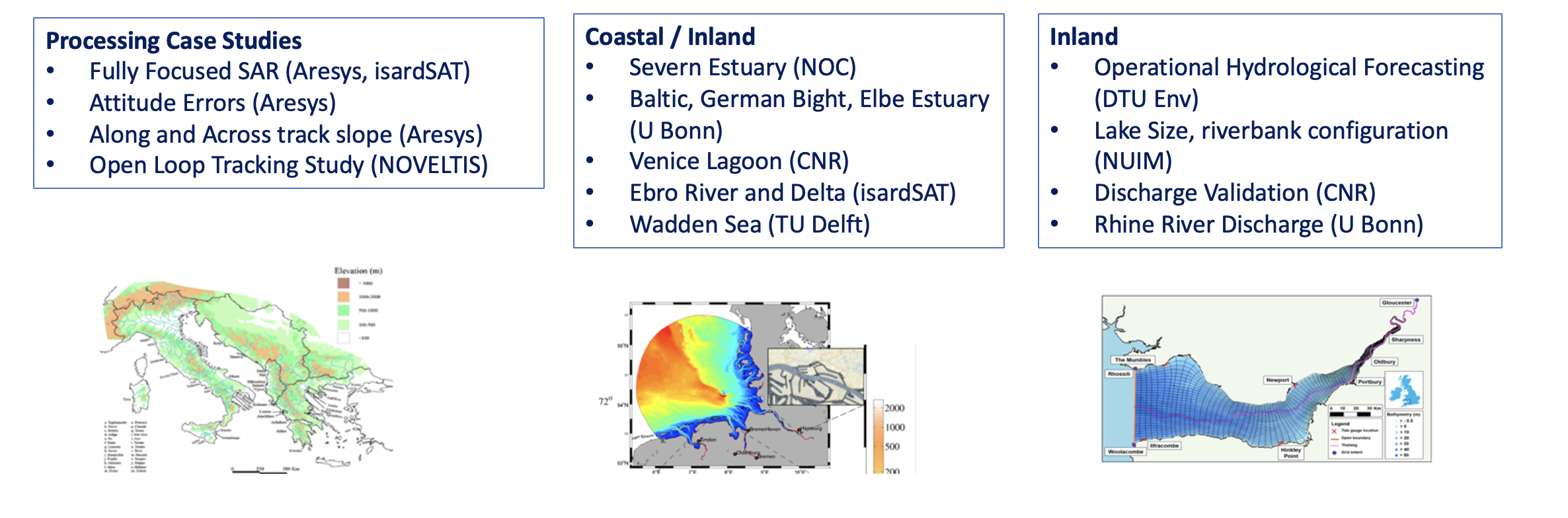
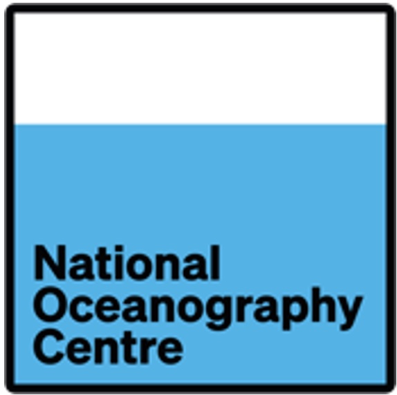
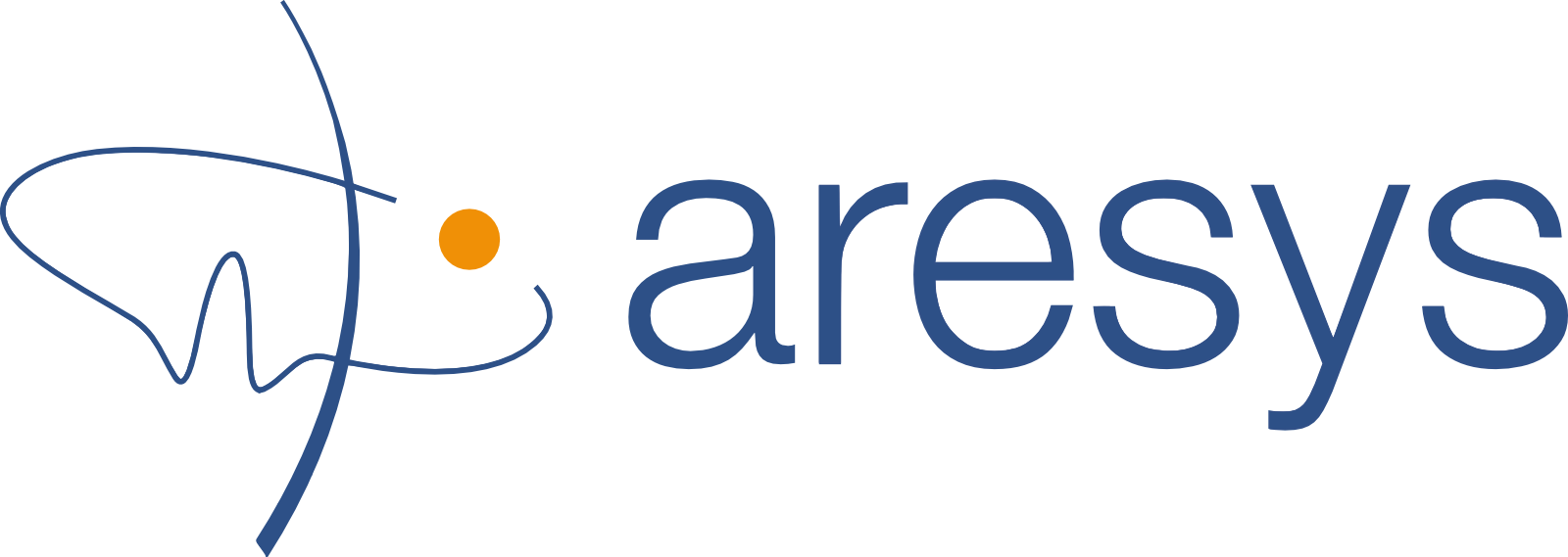
Case Studies to assess impact of Global Products:

  • Processor Case Studies.
  • Joint Coastal Zone and Inland Water Impact Assessment,
  • Inland Water Impact Assessment.

Acceptance Review (June 2023): Present and review Impact Assessment Reports.

Task 4 (June 2023 - September 2023): Scientific Roadmap

Develop a Scientific Roadmap identifying scientific priority areas, including

  • Recommendations and guidance for future scientific data exploitation projects.
  • Recommendations for algorithmic evolutions within baseline processing.
  • Recommendations for future interferometric altimetry missions.

Final Review (September 2023): Presentation and review of project results.

Project team

satoc isardsat noc

dtuspace ubonn aresys
noveltis dtuenv tum

uca atr cnr
nuim uporto tudelft


© Satellite Oceanographic Consultants Ltd 2020