FFSAR-Coastal Data Sets
                     | 
                   
                  
                    | 
                       In this section we list the data sets produced by the FFSAR-Coastal project. These data sets are available on-line through the FFSAR pages on the  UK Coastal Monitoring web-site     
                     | 


                      FFSAR Coastal in-situ data
                      
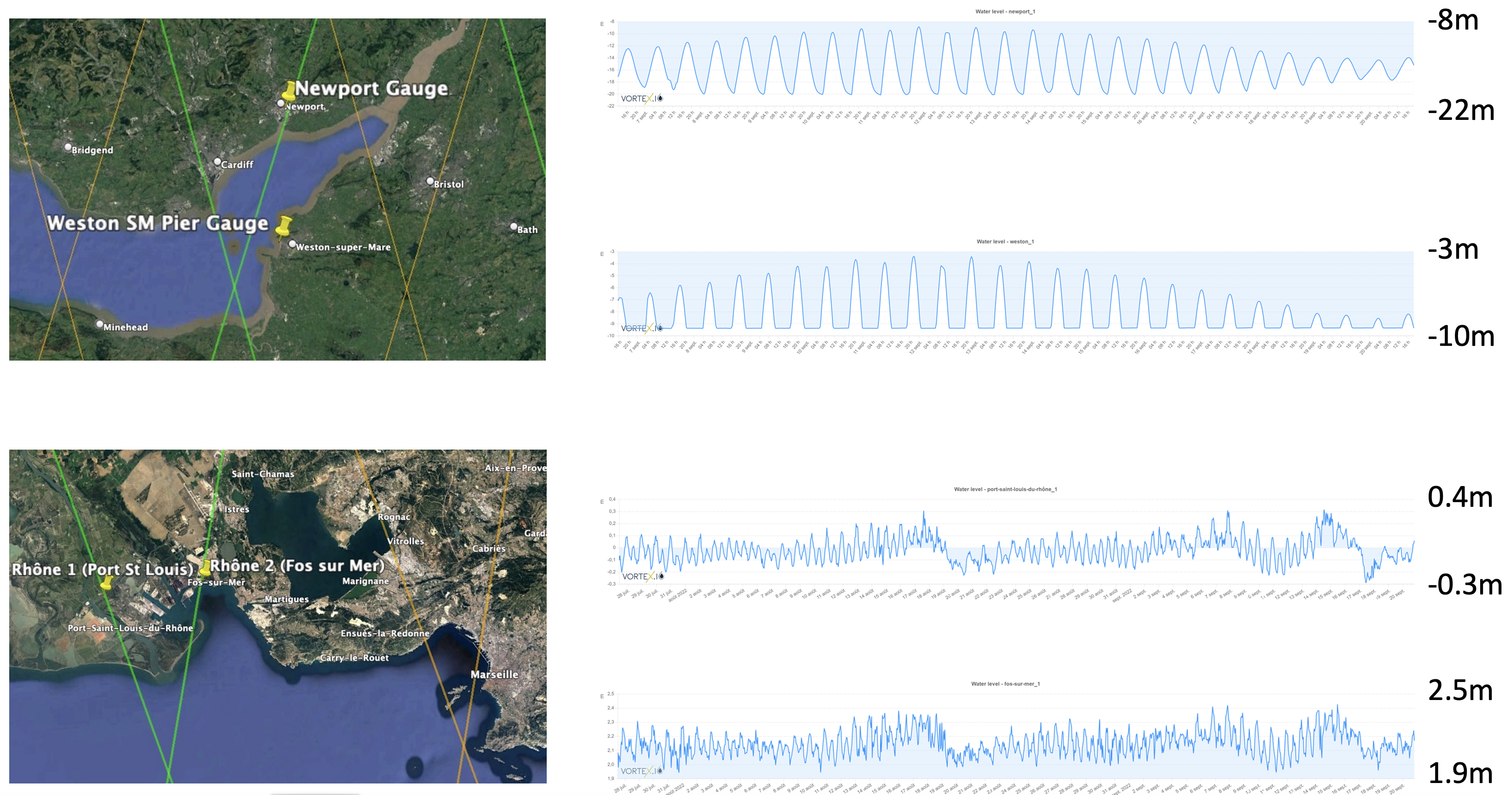
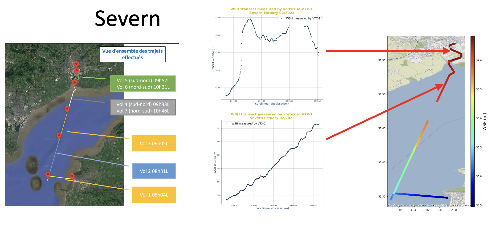
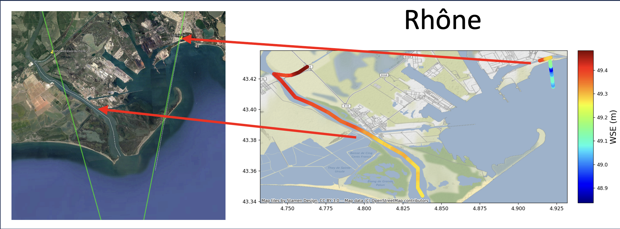
                        - The in situ data set comprises water level time series data from four VorteX.io micro-gauges, and water level profiles from two series of drone flights over the Severn and Rhone regions, as follows: 
 
                         
                       - Water Level Time Series from VorteX.io micro-gauges.
  
                        
                          -  Newport (06/09/22 onwards)
 
                          -  Weston Super Mare (06/09/22 onwards) - replaced on 06/04/23
 
                          -  Port St Louis du Rhone (27/07/22 onwards)
 
                          -  Fos sur Mer (27/07/22 onwards)


                        - Drone water level profiles.
 
                        
                          -  From micro-gauge locations, along Sentinel 3B ground tracks
 
                          -  Severn Estuary (24/03/23)
 
                          -  Rhone delta (13/04/23)


                     | 


                      FFSAR processed altimeter data
                      
                        - The FFSAR processed altimeter data sets comprise along-track data, for each pass of the Sentinel 3B satellite along the selected track across the Severn or Rhone regions; and time series data at selected points on the satellite tracks in each region
 
                        
 -  Along-track data
 
                        
                          -  Severn Estuary Sentinel 3B track 265
 
                          -  Rhone delta Sentinel 3B tracks 179 and 199
                           
                        
 -  Time Series data
                         
                          -  Severn Estuary
 
                          
                          -  "Tributary" - Entrance to the River Usk at Newport 
 
                          -  "Open"- Centre of Severn Estuary (5km NNE of Weston Super Mare) 
 
                           
                          - Rhone Delta.
 
                          
                          - Port St Louis - River North.
 
                          - Port St Louis - River South.
 
                          - Fos sur Mer - open
 
                          - Fos sur Mer - canal


                     | 


             |